Skip to product information
1 of 7

www.ChineseStandard.us -- Field Test Asia Pte. Ltd.

GB/T 44489-2024 English PDF (GB/T44489-2024)

GB/T 44489-2024 English PDF (GB/T44489-2024)

Regular price $215.00
Regular price Sale price $215.00
Sale Sold out
Shipping calculated at checkout.
GB/T 44489-2024: Requirements for examination of advanced assistant driving map
Delivery: 9 seconds. Download (& Email) true-PDF + Invoice.
Get Quotation: Click GB/T 44489-2024 (Self-service in 1-minute)
Historical versions (Master-website): GB/T 44489-2024
Preview True-PDF (Reload/Scroll-down if blank)

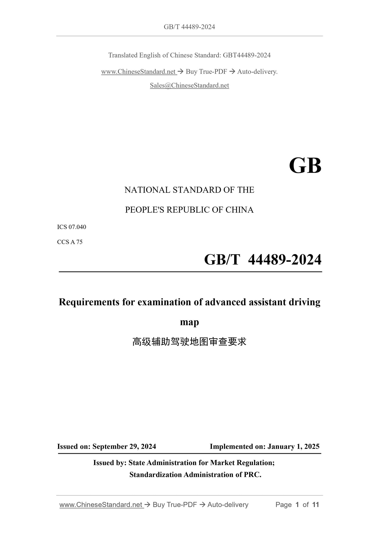
GB/T 44489-2024
GB
NATIONAL STANDARD OF THE
PEOPLE'S REPUBLIC OF CHINA
ICS 07.040
CCS A 75
Requirements for examination of advanced assistant driving
map
ISSUED ON: SEPTEMBER 29, 2024
IMPLEMENTED ON: JANUARY 1, 2025
Issued by: State Administration for Market Regulation;
Standardization Administration of PRC.
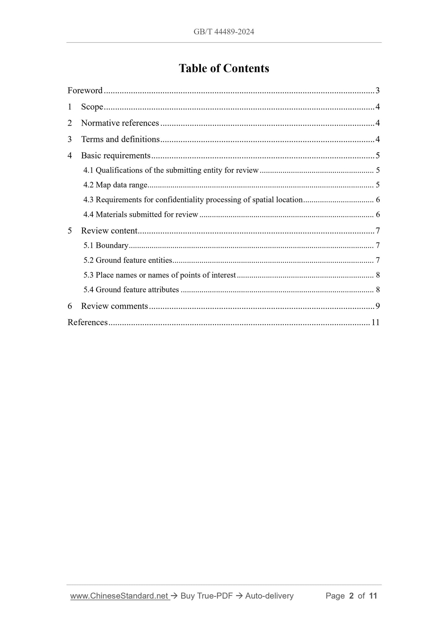
Table of Contents
Foreword ... 3
1 Scope ... 4
2 Normative references ... 4
3 Terms and definitions ... 4
4 Basic requirements ... 5
4.1 Qualifications of the submitting entity for review ... 5
4.2 Map data range ... 5
4.3 Requirements for confidentiality processing of spatial location ... 6
4.4 Materials submitted for review ... 6
5 Review content ... 7
5.1 Boundary ... 7
5.2 Ground feature entities ... 7
5.3 Place names or names of points of interest ... 8
5.4 Ground feature attributes ... 8
6 Review comments ... 9
References ... 11
Requirements for examination of advanced assistant driving
map
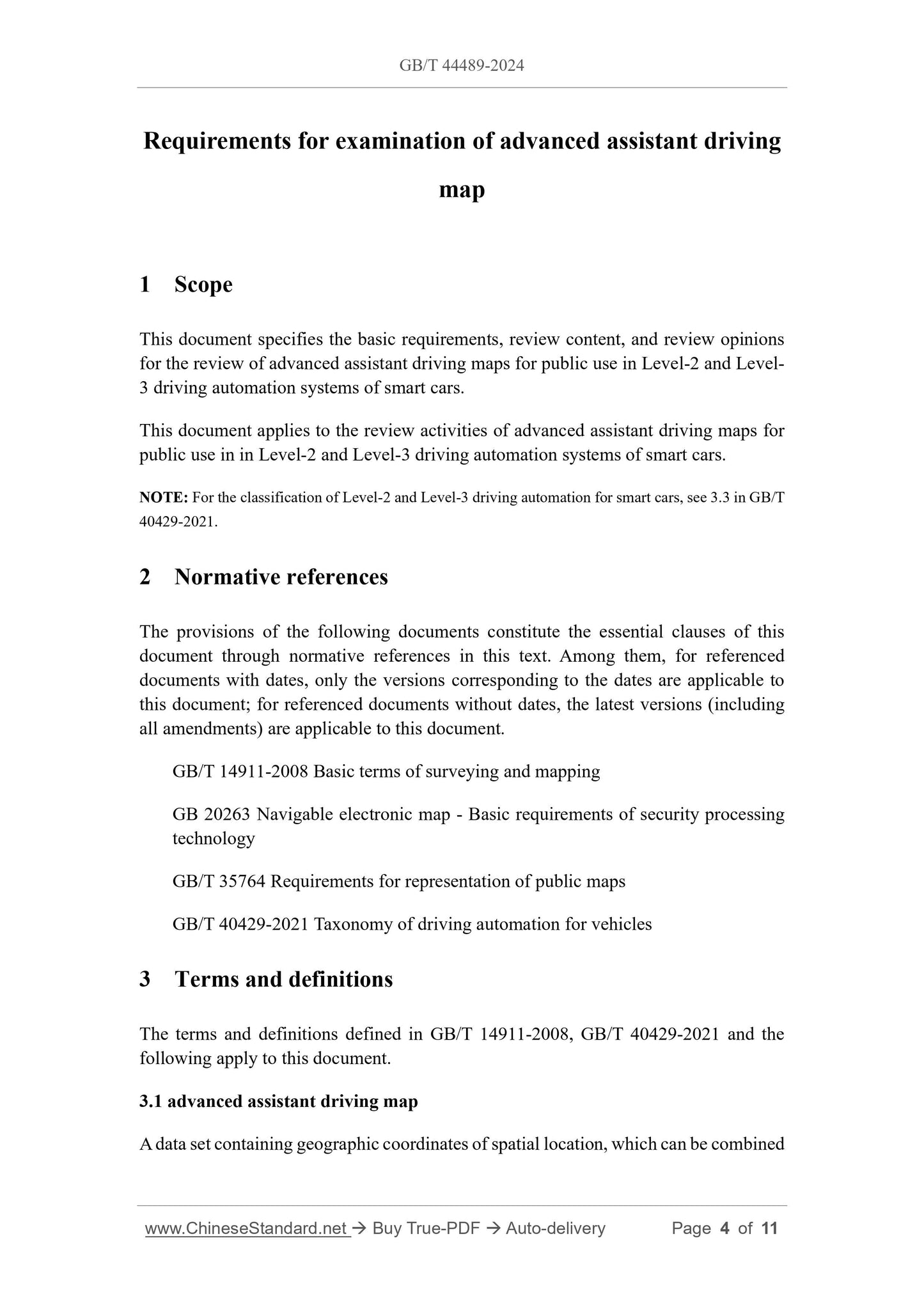
1 Scope
This document specifies the basic requirements, review content, and review opinions
for the review of advanced assistant driving maps for public use in Level-2 and Level-
3 driving automation systems of smart cars.
This document applies to the review activities of advanced assistant driving maps for
public use in in Level-2 and Level-3 driving automation systems of smart cars.
NOTE: For the classification of Level-2 and Level-3 driving automation for smart cars, see 3.3 in GB/T
40429-2021.
2 Normative references
The provisions of the following documents constitute the essential clauses of this
document through normative references in this text. Among them, for referenced
documents with dates, only the versions corresponding to the dates are applicable to
this document; for referenced documents without dates, the latest versions (including
all amendments) are applicable to this document.
GB/T 14911-2008 Basic terms of surveying and mapping
GB 20263 Navigable electronic map - Basic requirements of security processing
technology
GB/T 35764 Requirements for representation of public maps
GB/T 40429-2021 Taxonomy of driving automation for vehicles
3 Terms and definitions
The terms and definitions defined in GB/T 14911-2008, GB/T 40429-2021 and the
following apply to this document.
3.1 advanced assistant driving map
A data set containing geographic coordinates of spatial location, which can be combined
g) Internal roads and special roads within units and residential areas are not
included.
NOTE: For the description of rural roads and farm machinery roads, see 4.4 of GB/T 20257.1-2017.
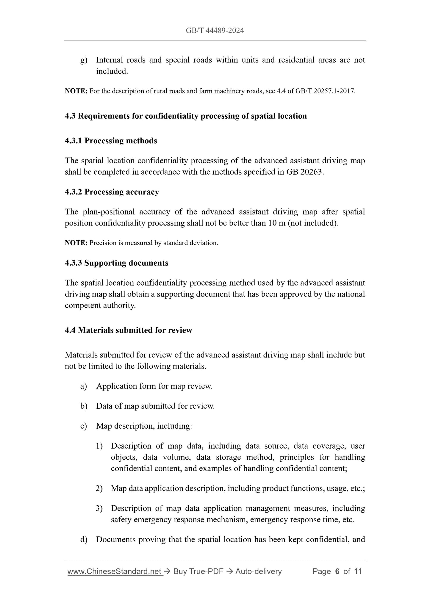
4.3 Requirements for confidentiality processing of spatial location
4.3.1 Processing methods
The spatial location confidentiality processing of the advanced assistant driving map
shall be completed in accordance with the methods specified in GB 20263.
4.3.2 Processing accuracy
The plan-positional accuracy of the advanced assistant driving map after spatial
position confidentiality processing shall not be better than 10 m (not included).
NOTE: Precision is measured by standard deviation.
4.3.3 Supporting documents
The spatial location confidentiality processing method used by the advanced assistant
driving map shall obtain a supporting document that has been approved by the national
competent authority.
4.4 Materials submitted for review
Materials submitted for review of the advanced assistant driving map shall include but
not be limited to the following materials.
a) Application form for map review.
b) Data of map submitted for review.
c) Map description, including:
1) Description of map data, including data source, data coverage, user
objects, data volume, data storage method, principles for handling
confidential content, and examples of handling confidential content;
2) Map data application description, including product functions, usage, etc.;
3) Description of map data application management measures, including
safety emergency response mechanism, emergency response time, etc.
d) Documents proving that the spatial location has been kept confidential, and
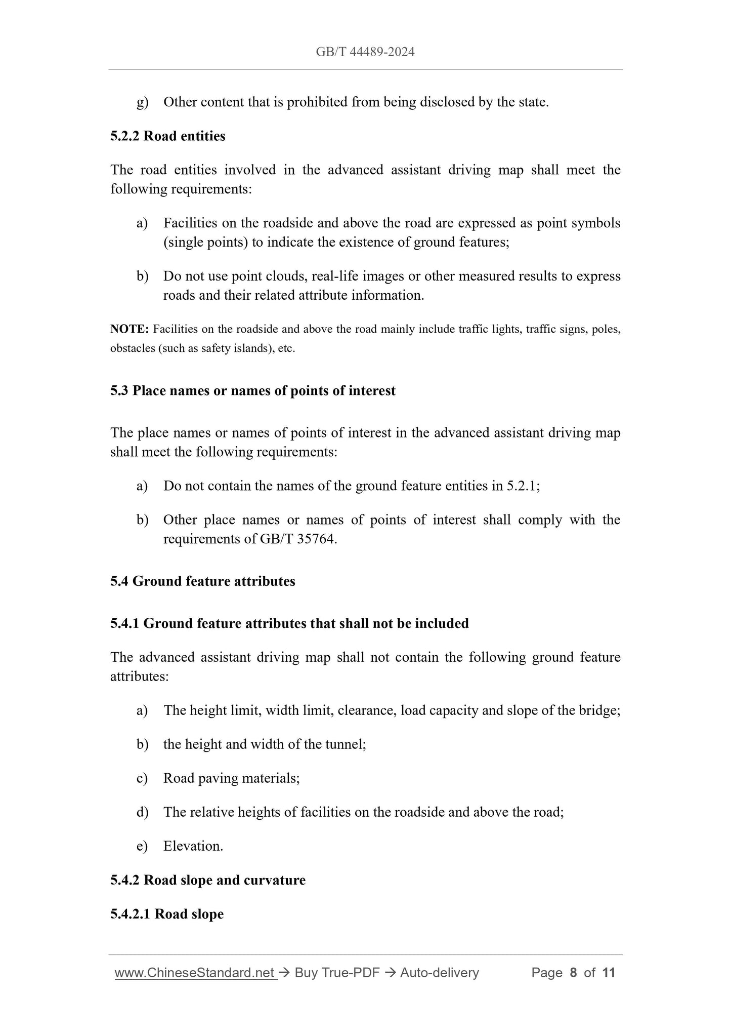
g) Other content that is prohibited from being disclosed by the state.
5.2.2 Road entities
The road entities involved in the advanced assistant driving map shall meet the
following requirements:
a) Facilities on the roadside and above the road are expressed as point symbols
(single points) to indicate the existence of ground features;
b) Do not use point clouds, real-life images or other measured results to express
roads and their related attribute information.
NOTE: Facilities on the roadside and above the road mainly include traffic lights, traffic signs, poles,
obstacles (such as safety islands), etc.
5.3 Place names or names of points of interest
The place names or names of points of interest in the advanced assistant driving map
shall meet the following requirements:
a) Do not contain the names of the ground feature entities in 5.2.1;
b) Other place names or names of points of interest shall comply with the
requirements of GB/T 35764.
5.4 Ground feature attributes
5.4.1 Ground feature attributes that shall not be included
The advanced assistant driving map shall not contain the following ground feature
attributes:
a) The height limit, width limit, clearance, load capacity and slope of the bridge;
b) the height and width of the tunnel;
c) Road paving materials;
d) The relative heights of facilities on the roadside and above the road;
e) Elevation.
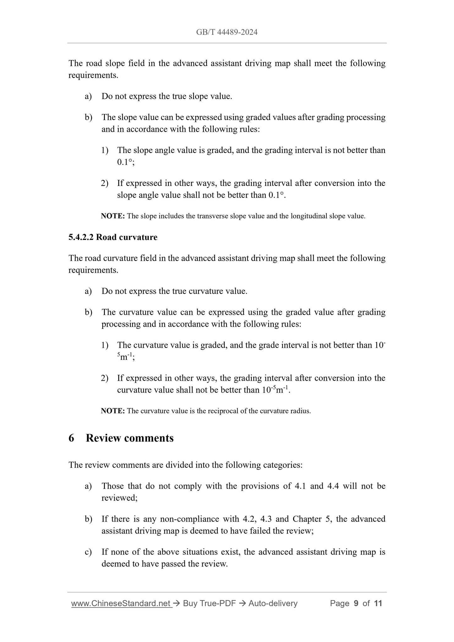
5.4.2 Road slope and curvature
5.4.2.1 Road slope
The road slope field in the advanced assistant driving map shall meet the following
requirements.
a) Do not express the true slope value.
b) The slope value can be expressed using graded values after grading processing
and in accordance with the following rules:
1) The slope angle value is graded, and the grading interval is not better than
0.1°;
2) If expressed in other ways, the grading interval after conversion into the
slope angle value shall not be better than 0.1°.
NOTE: The slope includes the transverse slope value and the longitudinal slope value.
5.4.2.2 Road curvature
The road curvature field in the advanced assistant driving map shall meet the following
requirements.
a) Do not express the true curvature value.
b) The curvature value can be expressed using the graded value after grading
processing and in accordance with the following rules:
1) The curvature value is graded, and the grade interval is not better than 10-
5m-1;
2) If expressed in other ways, the grading interval after conversion into the
curvature value shall not be better than 10-5m-1.
NOTE: The curvature value is the reciprocal of the curvature radius.
6 Review comments
The review comments are divided into the following categories:
a) Those that do not comply with the provisions of 4.1 and 4.4 will not be
reviewed;
b) If there is any non-compliance with 4.2, 4.3 and Chapter 5, the advanced
assistant driving map is deemed to have failed the review;
c) If none of the above situations exist, the advanced assistant driving map is
deemed to have passed the review.
GB/T 44489-2024
GB
NATIONAL STANDARD OF THE
PEOPLE'S REPUBLIC OF CHINA
ICS 07.040
CCS A 75
Requirements for examination of advanced assistant driving
map
ISSUED ON: SEPTEMBER 29, 2024
IMPLEMENTED ON: JANUARY 1, 2025
Issued by: State Administration for Market Regulation;
Standardization Administration of PRC.
Table of Contents
Foreword ... 3
1 Scope ... 4
2 Normative references ... 4
3 Terms and definitions ... 4
4 Basic requirements ... 5
4.1 Qualifications of the submitting entity for review ... 5
4.2 Map data range ... 5
4.3 Requirements for confidentiality processing of spatial location ... 6
4.4 Materials submitted for review ... 6
5 Review content ... 7
5.1 Boundary ... 7
5.2 Ground feature entities ... 7
5.3 Place names or names of points of interest ... 8
5.4 Ground feature attributes ... 8
6 Review comments ... 9
References ... 11
Requirements for examination of advanced assistant driving
map
1 Scope
This document specifies the basic requirements, review content, and review opinions
for the review of advanced assistant driving maps for public use in Level-2 and Level-
3 driving automation systems of smart cars.
This document applies to the review activities of advanced assistant driving maps for
public use in in Level-2 and Level-3 driving automation systems of smart cars.
NOTE: For the classification of Level-2 and Level-3 driving automation for smart cars, see 3.3 in GB/T
40429-2021.
2 Normative references
The provisions of the following documents constitute the essential clauses of this
document through normative references in this text. Among them, for referenced
documents with dates, only the versions corresponding to the dates are applicable to
this document; for referenced documents without dates, the latest versions (including
all amendments) are applicable to this document.
GB/T 14911-2008 Basic terms of surveying and mapping
GB 20263 Navigable electronic map - Basic requirements of security processing
technology
GB/T 35764 Requirements for representation of public maps
GB/T 40429-2021 Taxonomy of driving automation for vehicles
3 Terms and definitions
The terms and definitions defined in GB/T 14911-2008, GB/T 40429-2021 and the
following apply to this document.
3.1 advanced assistant driving map
A data set containing geographic coordinates of spatial location, which can be combined
g) Internal roads and special roads within units and residential areas are not
included.
NOTE: For the description of rural roads and farm machinery roads, see 4.4 of GB/T 20257.1-2017.
4.3 Requirements for confidentiality processing of spatial location
4.3.1 Processing methods
The spatial location confidentiality processing of the advanced assistant driving map
shall be completed in accordance with the methods specified in GB 20263.
4.3.2 Processing accuracy
The plan-positional accuracy of the advanced assistant driving map after spatial
position confidentiality processing shall not be better than 10 m (not included).
NOTE: Precision is measured by standard deviation.
4.3.3 Supporting documents
The spatial location confidentiality processing method used by the advanced assistant
driving map shall obtain a supporting document that has been approved by the national
competent authority.
4.4 Materials submitted for review
Materials submitted for review of the advanced assistant driving map shall include but
not be limited to the following materials.
a) Application form for map review.
b) Data of map submitted for review.
c) Map description, including:
1) Description of map data, including data source, data coverage, user
objects, data volume, data storage method, principles for handling
confidential content, and examples of handling confidential content;
2) Map data application description, including product functions, usage, etc.;
3) Description of map data application management measures, including
safety emergency response mechanism, emergency response time, etc.
d) Documents proving that the spatial location has been kept confidential, and
g) Other content that is prohibited from being disclosed by the state.
5.2.2 Road entities
The road entities involved in the advanced assistant driving map shall meet the
following requirements:
a) Facilities on the roadside and above the road are expressed as point symbols
(single points) to indicate the existence of ground features;
b) Do not use point clouds, real-life images or other measured results to express
roads and their related attribute information.
NOTE: Facilities on the roadside and above the road mainly include traffic lights, traffic signs, poles,
obstacles (such as safety islands), etc.
5.3 Place names or names of points of interest
The place names or names of points of interest in the advanced assistant driving map
shall meet the following requirements:
a) Do not contain the names of the ground feature entities in 5.2.1;
b) Other place names or names of points of interest shall comply with the
requirements of GB/T 35764.
5.4 Ground feature attributes
5.4.1 Ground feature attributes that shall not be included
The advanced assistant driving map shall not contain the following ground feature
attributes:
a) The height limit, width limit, clearance, load capacity and slope of the bridge;
b) the height and width of the tunnel;
c) Road paving materials;
d) The relative heights of facilities on the roadside and above the road;
e) Elevation.
5.4.2 Road slope and curvature
5.4.2.1 Road slope
The road slope field in the advanced assistant driving map shall meet the following
requirements.
a) Do not express the true slope value.
b) The slope value can be expressed using graded values after grading processing
and in accordance with the following rules:
1) The slope angle value is graded, and the grading interval is not better than
0.1°;
2) If expressed in other ways, the grading interval after conversion into the
slope angle value shall not be better than 0.1°.
NOTE: The slope includes the transverse slope value and the longitudinal slope value.
5.4.2.2 Road curvature
The road curvature field in the advanced assistant driving map shall meet the following
requirements.
a) Do not express the true curvature value.
b) The curvature value can be expressed using the graded value after grading
processing and in accordance with the following rules:
1) The curvature value is graded, and the grade interval is not better than 10-
5m-1;
2) If expressed in other ways, the grading interval after conversion into the
curvature value shall not be better than 10-5m-1.
NOTE: The curvature value is the reciprocal of the curvature radius.
6 Review comments
The review comments are divided into the following c...
View full details